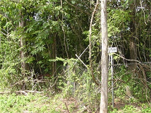
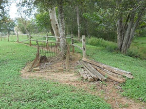
Hodge’s Bend Cemetery | FB-C024

Main Name: Hodge’s Bend Cemetery | FB-C024

Alternate Names:

  • White Lake Cemetery 

Access: Public

Location: Old Richmond Road, Sugar Land

NAD83 Coordinates: 29 38.446 N, 95 39.741 W

Map Coordinates: 29.640767, -95.662350

Status and Other Information: The cemetery status is inactive and it has a Historical Marker  The cemetery is not affiliated with any organizations and the ethnicity is primarily Anglo.  The size of the cemetery is 1.00 acre.  The number of known burials is 72 and the date of the earliest burial is 1831.


View Hodge’s Bend Cemetery - FB-C024 in a larger map


Hillsman Family Cemetery | FB-C088

Main Name: Hillsman Family Cemetery | FB-C088

Alternate Name:

  • Hillsman Cemetery

Access: Public

Location: Old Richmond Rd, Richmond

NAD83 Coordinates: 29 39.645 N, 95 39.579 W

Map Coordinates: 29.660750, -95.659650

View Hillsman Family Cemetery | FB-C088 in a larger map

Hillsman Cemetery

Main Name: Hillsman Family Cemetery | FB-C088

Alternate Name:

  • Hillsman Cemetery

Access: Public

Location: Old Richmond Rd, Richmond

NAD83 Coordinates: 29 39.645 N, 95 39.579 W

Map Coordinates: 29.660750, -95.659650

View Hillsman Family Cemetery | FB-C088 in a larger map

Henry Scott League Cemetery

Main Name: Foster Black Cemetery | FB-C087

Alternate Names:

  • Henry Scott League Cemetery

Access: Public

Location: Near Foster

NAD83 Coordinates: 29 33.671 N, 95 50.194 W

Map Coordinates: 29.561183, -95.836567

View Foster Black Cemetery | FB-C087 in a larger map


Henry Jones Cemetery

Main Name: Jones Memorial Cemetery, Henry & Nancy Stiles | FB-C035

Alternate Names:

  • George Ranch Cemetery
  • Henry Jones Cemetery
  • Jones Cemetery

Access: Cemetery access is via PRIVATE property. Permission from the land owner MUST be obtained prior to visiting the cemetery.

Location: George Road, Crabb

NAD83 Coordinates: 29 29.871 N, 95 40.917 W

Map Coordinates: 29.497850, -95.681950

Status and Other Information: The cemetery status is inactive.  The cemetery is not affiliated with any organizations and the ethnicity is mixed.  The size of the cemetery is 0.20 acre.


View Jones Memorial Cemetery, Henry & Nancy Stiles - FB-C035 in a larger map


Hayes Cemetery

Photo Taken Date: 2013

Plantation Road Cemetery | FB-C107

Main Name: Plantation Road Cemetery | FB-C107

Alternate Names:

  • Hayes Cemetery
  • Plantation Road Cemetery

Access: Access to the cemetery is via PRIVATE property. Permission from the land owner MUST be obtained prior to visiting the cemetery.

Location: Watts Plantation Rd, Missouri City

NAD83 Coordinates: 29 31.625 N, 95 31.553 W

Map Coordinates: 29.527083, -95.525883

Status and Other Information: The cemetery status is inactive. The cemetery is not affiliated with any organizations and the ethnicity is primarily Afro-American. The size of the cemetery is 0.03 acre. The number of known burials is 7 and the date of the earliest burial is 1905.

View Plantation Road Cemetery | FB-C107 in a larger map

Hatton – Ross Cemetery | FB-C086

Main Name: Hatton – Ross Cemetery | FB-C086

Alternate Names:

  • Colony Cemetery
  • Community Cemetery

Access: Cemetery access is via PRIVATE property. Permission from the land owner MUST be obtained prior to visiting the cemetery.

Location: Hatton Road, Orchard

NAD83 Coordinates: 29 37.342 N, 96 00.801 W

Map Coordinates: 29.622367, -96.013350

Status and Other Information: The cemetery status is active. The cemetery is not affiliated with any organizations and the ethnicity is primarily Afro-American. The size of the cemetery is 0.61 acres. The number of known burials is 27 and the date of the earliest burial is 10/20/1917.


View Hatton – Ross Cemetery - FB-C086 in a larger map

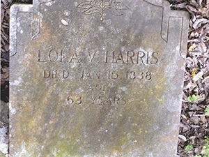
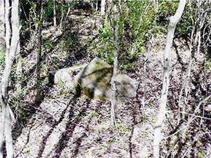
Harris Grave, Lola V.

 Photos Taken Date: 2009

Harris Grave, Lola V, Harris Grave, Lola V,
 

Main Name: Harris Family Cemetery | FB-C137

Alternate Names:

  • Harris Grave, Lola V.

Access: Cemetery access is via PRIVATE property. Permission from the land owner MUST be obtained prior to visiting the cemetery.

Location: Near Long Point Creek and FB Toll Rd, Arcola

NAD83 Coordinates: Latitude: 29 31.508 N, 95 29.289W

Map Coordinates: 29.52514,-95.48815

Status and Other Information: The cemetery status is inactive. The cemetery is not affiliated with a religious organization and the ethnicity is primarily Afro-American. The size of the cemetery is unknown. The number of known burials is 4 and the date of the earliest burial is 01/15/1838.

Harris Family Cemetery

 Photos Taken Date: 2009

Harris Grave, Lola V, Harris Grave, Lola V,
 

Main Name: Harris Family Cemetery | FB-C137

Alternate Names:

  • Harris Grave, Lola V.

Access: Cemetery access is via PRIVATE property. Permission from the land owner MUST be obtained prior to visiting the cemetery.

Location: Near Long Point Creek and FB Toll Rd, Arcola

NAD83 Coordinates: Latitude: 29 31.508 N, 95 29.289W

Map Coordinates: 29.52514,-95.48815

Status and Other Information: The cemetery status is inactive. The cemetery is not affiliated with a religious organization and the ethnicity is primarily Afro-American. The size of the cemetery is unknown. The number of known burials is 4 and the date of the earliest burial is 01/15/1838.

Harris Cemetery

Photo Taken Date: 2012

Randon Bottom Cemetery | FB-C109

Main Name: Randon Bottom Cemetery | FB-C109

Alternate Names:

  • Harris Cemetery
  • St. John’s Cemetery

Access: Access to the cemetery is via PRIVATE property. Permission from the land owner MUST be obtained prior to visiting the cemetery.

Location: Weston Lakes, Fulshear

NAD83 Coordinates: 29 39.130 N, 95 55.971 W

Map Coordinates: 29.652167, -95.932850

Status and Other Information: The cemetery status is inactive. The cemetery is not affiliated with any organizations and has no primary ethnicity. The size of the cemetery is 0.68 acres. The number of known burials is 71 and the date of the earliest burial is 08/28/1937.

View Randon Bottom Cemetery | FB-C109 in a larger map

Subscribe to Historical Commission