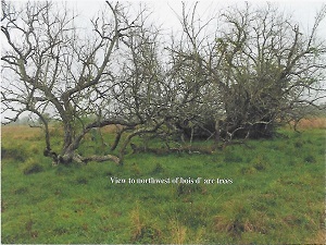
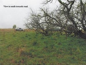
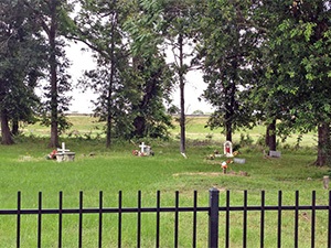
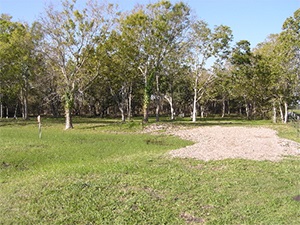
Krasna Cemetery | FB-C001

Main Name: Krasna Cemetery | FB-C001

Alternate Name(s): None

Access: Public

Location: B.J. Dusek Road, Rosenberg

NAD83 Coordinates: 29 35.361 N, 96 02.569 W

Map Coordinates: 29.589350, -96.042817

Status and Other Information: Work in Progress


View Krasna Cemetery - FB-C001 in a larger map


Koffman Cemetery

Main Name: Coffmann Family Cemetery | FB-C051

Alternate Names:

  • Cobbins Cemetery
  • Koffman Cemetery

Access: Cemetery access is via PRIVATE property.  Permission from the land owner MUST be obtained prior to visiting the cemetery.

Location: Fairway Drive, Richmond

NAD83 Coordinates: 29 34.258 N, 95 45.350 W

Map Coordinates: 29.570967, -95.755833

Status and Other Information: The cemetery status is active. The cemetery is not affiliated with any organizations and the ethnicity is primarily Afro-American. The size of the cemetery is 0.07 acres. The number of known burials is 13 and the date of the earliest burial is 1948.


View Coffmann Family Cemetery - FB-C051 in a larger map


Kitchen Property Cemetery

Main Name: Stage Line Cemetery | FB-C101

Alternate Names:

  • Kitchen Property Cemetery
  • Tadpole Bend Cemetery

Access: Access to the cemetery is via PRIVATE property. Permission from the land owner MUST be obtained prior to visiting the cemetery.

Location: Near FM-762, Guy

NAD83 Coordinates: 29 23.613 N, 95 38.492 W

Map Coordinates: 29.393550, -95.641533

Status and Other Information: The cemetery status is inactive. The cemetery is not affiliated with any organizations and has no primary ethnicity. The size of the cemetery is 0.04 acre.

View Stage Line Cemetery | FB-C101 in a larger map

Kirk Grave | FB-C154

Photo Taken Date: 2016
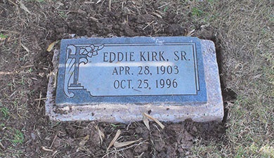
Kirk Grave | FB-C154

Main Name: Kirk Grave | FB-C154

Alternate Names:None

Access: Cemetery access is via PRIVATE property. Permission from the land owner MUST be obtained prior to visiting the cemetery.

Location: Near Cardinal Trail Court, Richmond

NAD83 Coordinates: 29 32.838 N, 95 42.745 W

Map Coordinates: 29.547391, -95.712420

Status and Other Information: The cemetery status is inactive. The cemetery is not affiliated with any organizations and the ethnicity is primarily Afro-American. The size of the cemetery is unknown. The number of known burials is 1 and the date is 1996.

View Kirk Grave | FB-C154 in a larger map

King Cemetery

Main Name: Randon Family Cemetery | FB-C111

Alternate Names:

  • King Cemetery
  • Pope Cemetery
  • Rice Cemetery

Access: Access to the cemetery is via PRIVATE property. Permission from the land owner MUST be obtained prior to visiting the cemetery.

Location: 104 Hillcrest Drive, Richmond

NAD83 Coordinates: 29 34.503 N, 95 45.385 W

Map Coordinates: 29.575050, -95.756417

Status and Other Information: The cemetery status is inactive. The cemetery is not affiliated with any organizations and has no primary ethnicity. The size of the cemetery is 0.01 acre. The number of known burials is 2 and the date of the earliest burial is unknown.

View Randon Family Cemetery | FB-C111 in a larger map

Kennedy League Cemetery | FB-C141

Photos Taken Date: 2016

Kennedy League Cemetery | FB-C141 | image a. Kennedy League Cemetery | FB-C141 | image b.

Main Name: Kennedy League Cemetery | FB-C141

Alternate Names: None

Access: Cemetery access is via PRIVATE property. Permission from the land owner MUST be obtained prior to visiting the cemetery.

Location: Near Orchard

NAD83 Coordinates: 29 38.224 N, 95 55.428 W

Map Coordinates: 29.58603, -95.67817

Status and Other Information: The cemetery status is inactive. The cemetery is not affiliated with any organizations and has no primary ethnicity.

Kendleton Cemetery | FB-C077

Main Name: Kendleton Cemetery | FB-C077

Alternate Names:

  • Oak Hill Baptist Cemetery
  • Paradise Garden Cemetery

Access: Public.

Location: Lum Rd, Kendleton

NAD83 Coordinates: 29 26.371 N, 96 00.052 W

Map Coordinates: 29.439517, -96.000867

Status and Other Information: The cemetery status is active. The cemetery is not affiliated with any organizations and the ethnicity is primarily Afro-American. The size of the cemetery is 1.16 acres. The number of burials is unknown and the date of the earliest burial is 10/04/1997.


View Kendleton Cemetery - FB-C077 in a larger map

Katy Community Cemetery

Photo Taken Date: 2017

Antioch Community Cemetery | FB-C122

Main Name: Antioch Community Cemetery | FB-C122

Alternate Names:

  • Katy Community Cemetery
  • Stockdick Cemetery

Access: There is public access to the cemetery.

Location: Stockdick Rd, Katy

NAD83 Coordinates: 29° 46' 43.68'' N, 95° 49' 48.046'' W

Map Coordinates: 29.7788, -95.830013

Status and Other Information: The cemetery status is active. The cemetery is not affiliated with any organizations and the ethnicity is mixed. The size of the cemetery is 0.73 acres. The number of known burials is 89 and the date of the earliest burial is 02/28/1963.


View Antioch Community Cemetery | FB-C122 in a larger map


Julif Area Cemetry

Photo Taken Date: 2009

Mt. Pilgrim Baptist Church | FB-C095

Main Name: Mt. Tabor Baptist Church Cemetery | FB-C096

Alternate Names:

  • Julif Area Cemetry
  • Mt. Tabor Cemetery

Access: Public

Location: 211 Porter Rd, Arcola

NAD83 Coordinates: 29 26.798 N, 95 28.593 W

Map Coordinates: 29.446633, -95.476550

Status and Other Information: The cemetery status is active. The cemetery is affiliated with a religious organization and the ethnicity is primarily Afro-American. The size of the cemetery is 0.27 acres. The number of known burials is 22 and the date of the earliest burial is 07/01/1984.

View Mt. Tabor Baptist Church Cemetery | FB-C096 in a larger map

Jones Memorial Cemetery, Henry & Nancy Stiles | FB-C035

Main Name: Jones Memorial Cemetery, Henry & Nancy Stiles | FB-C035

Alternate Names:

  • George Ranch Cemetery
  • Henry Jones Cemetery
  • Jones Cemetery

Access: Cemetery access is via PRIVATE property. Permission from the land owner MUST be obtained prior to visiting the cemetery.

Location: George Road, Crabb

NAD83 Coordinates: 29 29.871 N, 95 40.917 W

Map Coordinates: 29.497850, -95.681950

Status and Other Information: The cemetery status is inactive.  The cemetery is not affiliated with any organizations and the ethnicity is mixed.  The size of the cemetery is 0.20 acre.


View Jones Memorial Cemetery, Henry & Nancy Stiles - FB-C035 in a larger map


Subscribe to Historical Commission