Mt. Carmel Baptist Church Cemetery | FB-C034

Main Name: Mt. Carmel Baptist Church Cemetery | FB-C034

Alternate Names:

  • Mt. Carmel Cemetery

Access: Cemetery access is via PRIVATE property. Permission from the land owner MUST be obtained prior to visiting the cemetery.

Location: Clay Rd, Richmond

NAD83 Coordinates: 29 35.614 N, 95 45.764 W

Map Coordinates: 29.593567, -95.762733

Status and Other Information: The cemetery status is active and has a Historical Marker.  The cemetery is affiliated with a religious organization and the ethnicity is primarily Afro-American.  The size of the cemetery is 1.93 acres.  The number of known burials is 193 and the date of the earliest burial is 03/01/1910.


View Mt. Carmel Baptist Church Cemetery - FB-C034 in a larger map


Morton Cemetery | FB-C031

Main Name: Morton Cemetery | FB-C031

Alternate Names:

  • Richmond Cemetery

Access: Public

Location: 402 Morton St., Richmond

NAD83 Coordinates: 29 35.179 N, 95 45.692 W

Map Coordinates: 29.586317, -95.761533

Status and Other Information: The cemetery status is active and has a Historical Marker.  The cemetery is not affiliated with any organizations and the ethnicity is mixed.  The size of the cemetery is 15.478 acres.  The number of known burials is 3,043 and the date of the earliest burial is 11/07/1825.


View Morton Cemetery - FB-C031 in a larger map


Morning Star Baptist Church Cemetery | FB-C124

Morning Star Baptist Church Cemetery | FB-C124

Main Name: Morning Star Baptist Church Cemetery | FB-C124

Alternate Names:

  • Stransky Place Cemetery

Access: There is public access to the cemetery.

Location: Hubenak Rd, Needville

NAD83 Coordinates: 29 21.657 N, 95 51.866 W

Map Coordinates: 29.36095, -95.86444

Status and Other Information: The cemetery status is inactive. The cemetery is affiliated with a religious organizations and ethnicity is Afro-American. The size of the cemetery is 2.40 acres. The number of known burials is 8 and the date of the earliest burial is unknown.

View Morning Star Baptist Church Cemetery | FB-C124 in a larger map


Modena Hope Lutheran Cemetery

Main Name: Modena Cemetery | FB-C005

Alternate Names:

  • Baker Cemetery
  • Hope Lutheran Cemetery
  • Modena Hope Lutheran Cemetery

Access: Public

Location: Baker Road, Beasley

NAD83 Coordinates: 29 28.238 N, 95 53.936 W

Map Coordinates: 29.470633, -95.898933

Status and Other Information: The cemetery status is active. The cemetery is not affiliated with any organizations and the ethnicity is primarily Anglo. The size of the cemetery is 1.96 acres. The number of known burials is 209 and the date of the earliest burial is 06/17/1894.


View Modena Cemetery - FB-C005 in a larger map


Modena Cemetery | FB-C005

Main Name: Modena Cemetery | FB-C005

Alternate Names:

  • Baker Cemetery
  • Hope Lutheran Cemetery
  • Modena Hope Lutheran Cemetery

Access: Public

Location: Baker Road, Beasley

NAD83 Coordinates: 29 28.238 N, 95 53.936 W

Map Coordinates: 29.470633, -95.898933

Status and Other Information: The cemetery status is active. The cemetery is not affiliated with any organizations and the ethnicity is primarily Anglo. The size of the cemetery is 1.96 acres. The number of known burials is 209 and the date of the earliest burial is 06/17/1894.


View Modena Cemetery - FB-C005 in a larger map


Methodist Episcopal Cemetery

Main Name: Newman Chapel Cemetery | FB-C048

Alternate Names:

  • Baptist Cemetery
  • Methodist Episcopal Cemetery
  • Old Kendleton Cemetery

Access: Public

Location: Allen Bates Park, Kendleton

NAD83 Coordinates: 29 26.031 N, 96 00.334 W

Map Coordinates: 29.433850, -96.005567

Status and Other Information: The cemetery status is inactive.  The cemetery is affiliated with a religious organization and the ethnicity is primarily Afro-American.  The size of the cemetery is 0.75 acre.  The number of known burials is 18 and the date of the earliest burial is 05/13/1882.


View Newman Chapel Cemetery - FB-C048 in a larger map


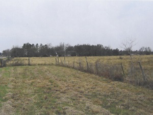
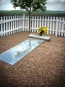
Mennonite Cemetery | FB-C093

Photo Taken Date: 2011

Mennonite Cemetery | FB-C093

Main Name: Mennonite Cemetery | FB-C093

Alternate Names: None

Access: Cemetery access is via PRIVATE property. Permission from the land owner MUST be obtained prior to visiting the cemetery.

Location: Janda Road, Fairchilds

NAD83 Coordinates: 29 26.624 N, 95 46.613 W

Map Coordinates: 29.443733, -95.776883

Status and Other Information: The cemetery status is inactive. The cemetery is not affiliated with any organizations and the ethnicity is primarily Anglo. The size of the cemetery is 0.02 acres. The number of known burials is 4 and the date of the earliest burial is unknown.

View Mennonite Cemetery | FB-C093 in a larger map

Mennonite Cemetery
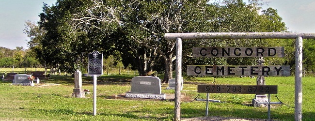
Concord Cemetery | FB-C012

Photo Date: 2011

Main Name: Concord Cemetery | FB-C012

Alternate Name: Mennonite Cemetery

Access: Public

Location: Fairchilds Road, Fairchilds

NAD83 Coordinates: 29 26.715 N, 95 45.765 W

Map Coordinates: 29.445250, -95.762750

Status and Other Information: The cemetery status is inactive. The cemetery is not affiliated with any organizations and the ethnicity is primarily Afro-American. The size of the cemetery is 1.32 acres. The number of known burials is 24 and the date of the earliest burial is 02/01/1888.


View Concord Cemetery - FB-C012 in a larger map


McKenzie Cemetery

Main Name: Andrews League Cemetery | FB-C027

Alternate Name: McKenzie Cemetery

Access: Cemetery access is via PRIVATE property. Permission from the land owner MUST be obtained prior to visiting the cemetery.

Location: Huntington Oaks Subdivision, Rosenberg

NAD83 Coordinates: 29 39.521 N, 95 48.390 W

Map Coordinates: 29.658683, -95.806500

Status and Other Information: The cemetery status is inactive. The cemetery is not affiliated with any organizations and the ethnicity is primarily Afro-American. The size of the cemetery is 1.32 acres. The number of known burials is 24 and the date of the earliest burial is 02/01/1888.


View Andrews League Cemetery - FB-C027 in a larger map


McKeever Cemetery | FB-C092

Main Name: McKeever Cemetery | FB-C092

Alternate Name: None

Access: Cemetery access is via PRIVATE property. Permission from the land owner MUST be obtained prior to visiting the cemetery.

Location: Lawson Road, Arcola

NAD83 Coordinates: 29 29.629 N, 95 29.715 W

Map Coordinates: 29.493817, -95.495250

Status and Other Information: The cemetery status is inactive. The cemetery is not affiliated with any organizations and has no primary ethnicity. The size of the cemetery is unknown. The number of known burials is 1 and the date of the earliest burial is 11/30/1980.

View McKeever Cemetery | FB-C092 in a larger map

Subscribe to Historical Commission