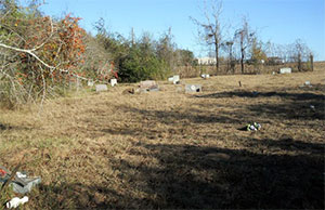
Powell Point Cemetery | FB-C050

Main Name: Powell Point Cemetery | FB-C050

Alternate Names:

  • None

Access: Public

Location: Burnett Road, Kendleton

NAD83 Coordinates: 29 29.449 N, 96 02.078 W

Map Coordinates: 29.490817, -96.034633

Status and Other Information: The cemetery status is active and it has a Historical Marker.  The cemetery is not affiliated with any organizations and the ethnicity is primarily Afro-American.  The size of the cemetery is unknown.  The number of known burials is 806 and the date of the earliest burial is 11/18/1889.


View Powell Point Cemetery - FB-C050 in a larger map


Powell Family Cemetery

Photo Taken Date: 2012

Bains Family Cemetery | FB-C032

Main Name: Powell Family Cemetery | FB-C168

Alternate Names:

  • None

Access: Cemetery access is via PRIVATE property. Permission from the land owner MUST be obtained prior to visiting the cemetery.

Location: Near Wallis St., Fulshear

NAD83 Coordinates: 29 42.641 N, 95 56.234 W

Map Coordinates: 29.71068, -95.937068

Status and Other Information:

The cemetery status is active.  The cemetery is affiliated with a family organization and the ethnicity is primarily Afro-American.  The size of the cemetery is 0.93 acres.  The number of known burials is 27 and the date of the earliest burial is June 1977.


View Powell Family Cemetery | FB-C168 in a larger map


Pope Cemetery

Main Name: Randon Family Cemetery | FB-C111

Alternate Names:

  • King Cemetery
  • Pope Cemetery
  • Rice Cemetery

Access: Access to the cemetery is via PRIVATE property. Permission from the land owner MUST be obtained prior to visiting the cemetery.

Location: 104 Hillcrest Drive, Richmond

NAD83 Coordinates: 29 34.503 N, 95 45.385 W

Map Coordinates: 29.575050, -95.756417

Status and Other Information: The cemetery status is inactive. The cemetery is not affiliated with any organizations and has no primary ethnicity. The size of the cemetery is 0.01 acre. The number of known burials is 2 and the date of the earliest burial is unknown.

View Randon Family Cemetery | FB-C111 in a larger map

Pool Hill Cemetery | FB-C108

Main Name: Pool Hill Cemetery | FB-C108

Alternate Names: None

Access: Public

Location: Bowser Road, Fulshear

NAD83 Coordinates: 29 40.766 N, 95 56.658 W

Map Coordinates: 29.679433, -95.944300

Status and Other Information: The cemetery status is active. The cemetery is not affiliated with any organizations and the ethnicity is primarily Afro-American. The size of the cemetery is [2/53 acres]. The number of known burials is 116 and the date of the earliest burial is 05/01/1926.

View Pool Hill Cemetery | FB-C108 in a larger map

Pleasant Hill Missionary Baptist Church Cemetery | FB-C003

Main Name: Pleasant Hill Missionary Baptist Church Cemetery | FB-C003

Alternate Names:

  • Pleasant Hill Cemetery
  • Pleasant Hill Baptist Cemetery

Access: There is public access to the cemetery.

Location: Bois d’Arc Lane, Fulshear

NAD83 Coordinates: 29 39.332 N, 95 52.987 W

Map Coordinates: 29.655533, -95.883117

Status and Other Information: The cemetery status is active and it has a Historical Marker. The cemetery is affiliated with a religious organization and has no primary ethnicity. The size of the cemetery is 2 acres. The number of known burials is 81 and the date of the earliest burial is 05/19/1935.


View Pleasant Hill Missionary Baptist Church Cemetery - FB-C003 in a larger map


Pleasant Hill Cemetery

Main Name: Pleasant Hill Missionary Baptist Church Cemetery | FB-C003

Alternate Names:

  • Pleasant Hill Cemetery
  • Pleasant Hill Baptist Cemetery

Access: There is public access to the cemetery.

Location: Bois d’Arc Lane, Fulshear

NAD83 Coordinates: 29 39.332 N, 95 52.987 W

Map Coordinates: 29.655533, -95.883117

Status and Other Information: The cemetery status is active and it has a Historical Marker. The cemetery is affiliated with a religious organization and has no primary ethnicity. The size of the cemetery is 2 acres. The number of known burials is 81 and the date of the earliest burial is 05/19/1935.


View Pleasant Hill Missionary Baptist Church Cemetery - FB-C003 in a larger map


Pleasant Hill Baptist Cemetery

Main Name: Pleasant Hill Missionary Baptist Church Cemetery | FB-C003

Alternate Names:

  • Pleasant Hill Cemetery
  • Pleasant Hill Baptist Cemetery

Access: There is public access to the cemetery.

Location: Bois d’Arc Lane, Fulshear

NAD83 Coordinates: 29 39.332 N, 95 52.987 W

Map Coordinates: 29.655533, -95.883117

Status and Other Information: The cemetery status is active and it has a Historical Marker. The cemetery is affiliated with a religious organization and has no primary ethnicity. The size of the cemetery is 2 acres. The number of known burials is 81 and the date of the earliest burial is 05/19/1935.


View Pleasant Hill Missionary Baptist Church Cemetery - FB-C003 in a larger map


Pleasant Green Missionary Baptist Cemetery | FB-C025

Main Name: Pleasant Green Missionary Baptist Cemetery | FB-C025

Alternate Names:

  • Pleasant Green Cemetery

Access: Public

Location: Madden Road, Clodine

NAD83 Coordinates: 29 39.390 N, 95 42.409 W

Map Coordinates: 29.656500, -95.706817

Status and Other Information: The cemetery status is active.  The cemetery is affiliated with a religious organization and the ethnicity is primarily Afro-American.  The size of the cemetery is 1.91 acres.  The number of known burials is 183 and the date of the earliest burial is 06/10/1914.


View Pleasant Green Missionary Baptist Cemetery - FB-C025 in a larger map


Pleasant Green Cemetery

Main Name: Pleasant Green Missionary Baptist Cemetery | FB-C025

Alternate Names:

  • Pleasant Green Cemetery

Access: Public

Location: Madden Road, Clodine

NAD83 Coordinates: 29 39.390 N, 95 42.409 W

Map Coordinates: 29.656500, -95.706817

Status and Other Information: The cemetery status is active.  The cemetery is affiliated with a religious organization and the ethnicity is primarily Afro-American.  The size of the cemetery is 1.91 acres.  The number of known burials is 183 and the date of the earliest burial is 06/10/1914.


View Pleasant Green Missionary Baptist Cemetery - FB-C025 in a larger map


Plantation Road Cemetery | FB-C107

Photo Taken Date: 2013

Plantation Road Cemetery | FB-C107

Main Name: Plantation Road Cemetery | FB-C107

Alternate Names:

  • Hayes Cemetery
  • Plantation Road Cemetery

Access: Access to the cemetery is via PRIVATE property. Permission from the land owner MUST be obtained prior to visiting the cemetery.

Location: Watts Plantation Rd, Missouri City

NAD83 Coordinates: 29 31.625 N, 95 31.553 W

Map Coordinates: 29.527083, -95.525883

Status and Other Information: The cemetery status is inactive. The cemetery is not affiliated with any organizations and the ethnicity is primarily Afro-American. The size of the cemetery is 0.03 acre. The number of known burials is 7 and the date of the earliest burial is 1905.

View Plantation Road Cemetery | FB-C107 in a larger map

Subscribe to Historical Commission